

") The increase in the atmospheric temperature of our mother Earth has forced governments to spend heavily on solutions that help tackle global warming. Billions of dollars have been spent in building advanced satellites that help monitor the climate on Earth. Given below are some satellites that constantly keep a vigil over our environment.
The increase in the atmospheric temperature of our mother Earth has forced governments to spend heavily on solutions that help tackle global warming. Billions of dollars have been spent in building advanced satellites that help monitor the climate on Earth. Given below are some satellites that constantly keep a vigil over our environment.
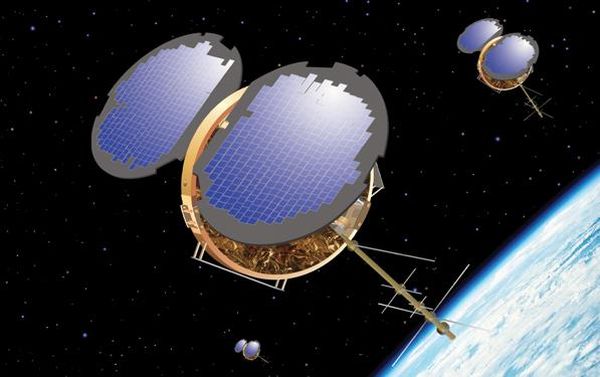
1. Gravity Field and steady-state Ocean Circulation Explorer (GOCE)
")
Launched two years back by the European Space Agency, the GOCE satellite monitors the earthâs gravity field with great accuracy. Placed 260 km above the earth, this satellite gives vital data which helps scientists measure the extent of atmospheric alterations on the aquatic drama of the earth â ice sheets, sea level and oceanic circulations. The satellite is 16 feet long and weighs 2,310 pounds.
2. Earth Observing System satellite – EOS Aura

Launched by NASA in 2004, as part of its flagship program to protect and have a better understanding about the earthâs atmosphere, Aura allows scientists to monitor each day on planet with great details. The main objectives behind launching Aura were to know whether the ozone layer was improving, how our climate was changing and which processes governed the air quality. It is positioned 705 km above the Earth surface.
3. Earth Observing System â Aqua

This Satellite, too, is a part of NASAâs program which helps in monitoring our atmosphere. It was launched in 2002, with the aim to provide detailed information about the climate by measuring clouds, snow, sea surface and ice, moisture content, and terrestrial snow.
4. Earth Observing System satellite – EOS Terra

Again a NASA satellite, it helps in gauging the effect of environmental changes. This satellite is supposed to present a mind boggling set of 15 years global climatic data, which would help scientists decipher the entire atmospheric game.
5. TRMM satellite- Tropical Rainfall Measuring Mission

Rain is something which is difficult to predict with high accuracy. For the first time in history, the TRMM Satellite will help scientists understand and measure tropical and subtropical rain. This is important as it will help in making a better forecast, predicting floods, droughts, oceanic movements and wind flows.
6. The Landsat 7 Satellite

A 5,000 pound-class remote sensing satellite, the Landsat 7 spins on a 705 km long ellipse. In fact, there is a series of Landsat, the 7th one being the latest. The 5th brother has a multispectral scanner and a Thematic Mapper. Both these devices help to track solar radiation, which is split into four bands after being reflected from the earthâs surface.
7. Formosat3 / COSMIC (F3C)
A Taiwan – US mission for tracking weather, climate, space, weather and conducting geodetic research, the F3C has six micro satellites. The mission has been a success, since all the micro-satellites, varying advanced GPS devices are working well.
8. CloudSat

It is an observation satellite, of course, again a NASA product. It measures the altitude of clouds. The main role is to give information regarding the connection between clouds and climate. The information is vital, since scientists see this relation as being attached somewhere to the problem of global warming.
9. CALIPSO

The Cloud-Aerosol Lidar and Infrared Pathfinder Satellite Observation, abbreviated as CALIPSO, is a partnership program of NASA and CNES, French Space Agency and is supposed to have a life of three years. This satellite has been employed to get a detailed view of the climatic changes. This is unique in the fact that the satellite would be the first to produce data regarding distribution of clouds and aerosols by use of a form of laser radar.
10. TerraSAR-X Satellite

The German Aerospace Centre DLR and EADS Astrium GmbH have joined hands and given birth to this instrument. The Satellite is positioned in a polar orbit 514 km above Earth. The best part of this satellite is that it is powered by solar cells, since it is positioned to follow the day night cycle of the earth, ensuring a constant exposure to the Sun. The satellite is meant to give data regarding artificial disasters like floods and military conflicts.